If you aren't getting deeply involved in some innovative feature, you can't figure out how getting the most from it. In the last months I started driving my car along a suburban road, which is quiet at most, but it sometimes blows up at working hours. I drive that road in those hours, so I'm part of the crowd, that makes everything so slow: that's my fault!
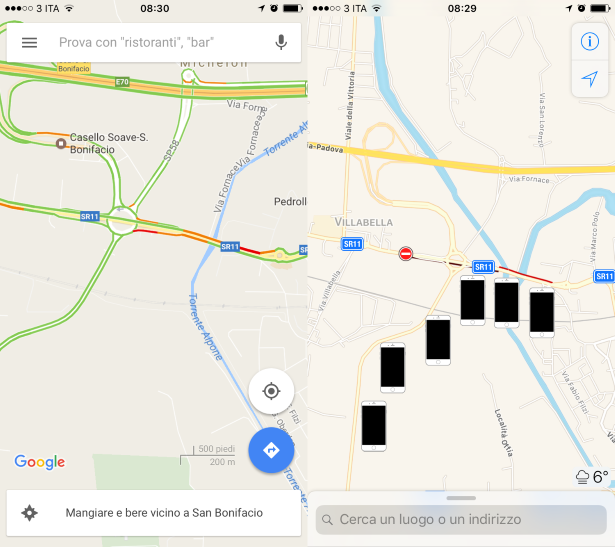
After experiencing my first queues, I started using often maps services like Google and Apple's too, especially the traffic feature. Both the apps display those information basically in the same way: the green path over the road shows no evidence of queue, the yellow marks a slower speed than the usual average speed. The red path states the existence of the queue, which means that several vehicles are lying along the trackway.
This feature is available from various information systems since about two decades: how do they exactly work? If I look backward, I think of a not-so-different service offered by the highway management systems through the horizontal textual display placed along the path: you know what I mean.
I'm experienced enough that those information have never been very precise and useful. Response time doesn't seem to have been ever quick at refreshing.
When the queue starts growing, the system makes you know only after some manned intervention. When the queue has disappeared and normal conditions are restored again, it seems that the information system isn't refreshed in real time for the same reason: information systems are not controlled in a completely automatic way.
Last time it happened again in my area: all the cars exited the motorway due to the panic, so that the crowd moved from the highway to the adjacent local roads. The former became completely free, the latter blew up, whilst information system was still stating the unupdated status: "Faulty highway from Soave to Verona with a 9 kilometers queue".
May you get valuable help from such an unresponsive and uneffective service? It may help you to avoid some hour in a longer travel, like during the summer or Christmas holidays, but it's absolutely unuseful for everybody driving daily the highway or the shorter suburban roads.
Let's see how these automatic services work like Google's or Apple's: they are based on pervasive technology, as crowdsourcing. They use a collaborative approach: any user device, mainly any smartphone, is being used anonymously to send real-time position during an interval frame along some city or suburban road. Any competitor, like Google, Tomtom, Apple, Microsoft worked hardly and is going to keep on fixing and make it better, as you may see in this patent registered by Apple.
As soon as all those data are collected in a huge database - tons of smartphone localizations along a road in a short time interval and the average speed of those devices tends to decrease importantly than the average speed at that hour on that road, the software builds its hypothesis: a car queue is growing up.
The algorhytm needs to be adjusted for such detection, in order to avoid false positives. Let's recall some typical patterns to check:
- you need a minimum amount of devices to detect condition (two phones are not enough)
- vehicle speed should have large standard deviation (on-off speed is desired)
- maximum speed along the track needs to outperform average speed of pedestrians or cyclists (don't confuse with other travellers)
- minimum speed could reset to zero, although you could confuse with people at road sides
- average distance between devices along the virtual polyline must not be lower that a fixed value (smartphones are inside vehicles which have larger sizes than human bodies)
There are also other false positives, like crowds at train station or at tube, their unregular positions quite differen from a row, a flashmob, or a group of fans taking part a concert or a sporting event. There's plenty of exceptional cases, which could be detected as traffic crowds, so they need to be manually fixed with blacklists centered towards to stations, squares, or stadiums.
What's amazing of those automatic system is the reaction time, which has been lowered at a value less than a minute. Such threshold is just what you need to take fast decisions in the traffic jam also for local or bounded cases. The travelling time revised with the realtime traffic is a great point to start to offer smart tracks and lets you bypass the lock. Waze was one the first services to work in such manner.